Bradford to help identify submerged landscapes on Gulf of Mexico
The University of Bradford is partnering with a host of American institutions on a project to improve methods for identifying submerged landscapes offshore in the Gulf of Mexico.
The five-year project, funded by the US Federal agency, the Bureau of Ocean Energy Management (BOEM), has received $1.5 million (£1.1m) to identify and then study submerged archaeological landscapes in the region that was dry land during the last Ice Age, drowned since then by sea-level rise.
It will integrate Indigenous Tribal communities during all phases of research through workshops, training, fieldwork opportunities, and the development of an open-access online short course in submerged landscape archaeology.
The project, ‘Re-evaluating BOEM’s Guidelines for Identifying Submerged Pre-Contact Archaeological Sites in the Gulf of Mexico: An Extensive Geoarchaeological Approach’, includes Dr Simon Fitch and Dr Jess Cook Hale from the University of Bradford’s Submerged Landscapes Research Centre and partners from the Florida State University’s Native American and Indigenous Studies Center, Texas A&M’s Center for the Study of First Americans, University of Tennessee, Chattanooga and Smithsonian Institute.
Exciting project
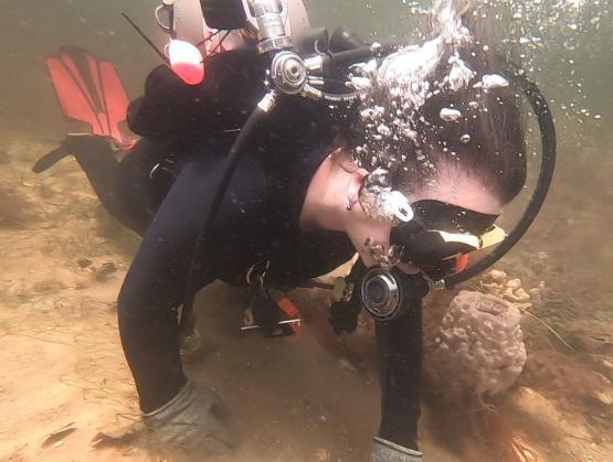
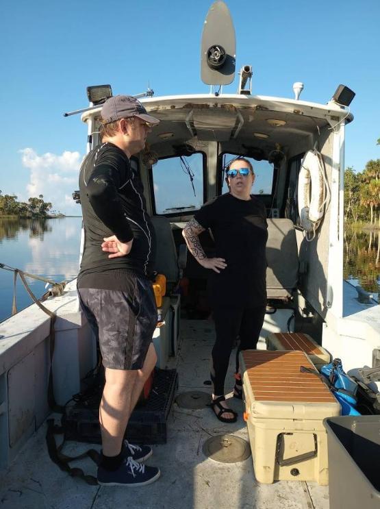
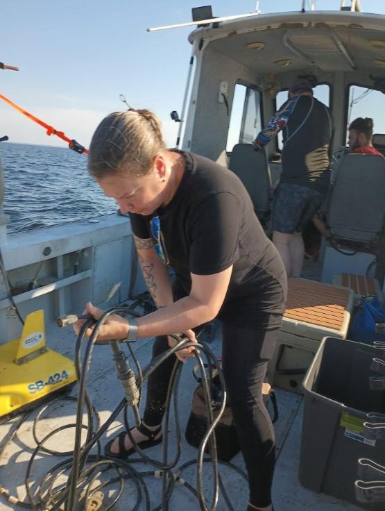
They will carry out offshore surveys in the Gulf of Mexico, which includes coastlines along Texas, Louisiana, Mississippi, Alabama and Florida. The project will trial new methods to detect archaeological sites. Divers will carry out further analysis work at known, documented archaeological sites along the Gulf of Mexico to improve analytical methods.
The University of Bradford will recruit an international PhD student in 2025 who will work on the project for three years from its Submerged Landscapes Centre. It is hoped the selected student will be from an Indigenous background or have experience of working closely with those communities.
Dr Fitch said: “It’s really exciting. People from Indigenous backgrounds have a culture that stems back tens of thousands of years.
“As a broader society, we’ve not paid as much attention to that as we should have done. It’s important to acknowledge it. It is part of their history and culture.”
Despite more than a century of research, archaeologists still have many questions about sites left behind by people that lived on these landscapes before sea-level rise drowned them. Fewer than 50 such submerged sites have been documented in the Gulf of Mexico, many of them in semi-disturbed conditions.
A larger number of sites need to be detected and analysed to advance scientific understanding of these periods of human history and to improve cultural heritage management practices. The project results will provide updated guidance to BOEM for identifying and managing these submerged landscapes in the Gulf of Mexico, guiding US Federal policy for cultural heritage management in this sector.
The project will help train the next generation of submerged landscape archaeologists. Up to two dozen students will be trained in areas including geophysics, modelling, geoarchaeological sampling and recording techniques.
Students from disadvantaged backgrounds and all historically underrepresented groups will be recruited.
The project will include training and analysis workshops with Tribal communities during each year of the project.
Dr Cook Hale said: “One of the most important aspects of this project is knowledge transfer to Tribal Nations across the region. We know from multiple global examples that Indigenous stewardship of landscapes results in better outcomes.
“The Gulf has a long history of offshore development in oil and gas prospection that is now evolving into green initiatives such as offshore wind. It is critical that Tribal Nations be at the forefront of caring for these landscapes going forward, and we’re really pleased to be part of a project that can support that effort.”
Increasing engagement
The project aims to increase Tribal engagement for submerged landscape research. All data and models will be analysed collaboratively with Tribal partners to define areas of interest to the Tribes.
The Gulf of Mexico coastal plain was a dramatically different landscape during the last Ice Age. When the Ice Age ended, dozens of large and small species of animals died out or migrated to new lands while the region transformed from a coastal plain, to wetlands, to underwater as sea levels rose more than 100 metres.
Indigenous people were present in the Americas during these transformations, including on this now-drowned coastal plain. Their societies would have had to manage impacts as the Ice Age ended, including multiple environmental changes and the submergence of entire landscapes.
The University of Bradford’s Faculty of Life Sciences now has the largest submerged landscapes research group in the world and is one of the few places specialising in what is an emerging academic discipline. The Gulf of Mexico collaboration is the latest success for the University of Bradford’s Submerged Landscapes Research Centre (SLRS).
Other projects include Life on the Edge, part of a UKRI FLF (future leaders fellowship) for Dr Fitch, which last year attracted just over £1m in funding from UKRI, as well as £400,000 in-kind ship time from VLIZ (Flanders Marine Institute), and a PhD studentship from the university.
The FLF funding for Life on the Edge has helped to enable the centre to perform global research of submerged landscapes. This has seen Dr Fitch undertake significant extensive submerged archaeological landscape surveys in Croatia, Belgium, the UK as well as other smaller surveys worldwide.
In 2023, the centre was awarded funding for SUBNORDICA project, an ambitious programme of research focused on the seabed of the Baltic and North Seas. This is funded by a €8m (just under £7m) European Research Council grant. Using underwater drones and advanced 3D seismic sensors to create maps of coastlines, the study led by the University of Bradford, will attempt to find new evidence of human settlements during the last Ice Age.